Wilson Conservation Lands – Bracebridge Road
Overview
Woods and gardens above and adjacent to the Cochituate and Sudbury Aqueducts. Historic stone bridge that once crossed a stream connecting two small ponds, as shown on an 1895 map.
Size: 0.5 acres (conservation area) + 1.5 acres (conservation restriction) Longest Walk: 0.2 miles Acquired: 1990s and 2012
Maps
Locator Map and Driving Directions
Other maps and aerial photos:
Connects to: Aqueduct Trails
Trail Map
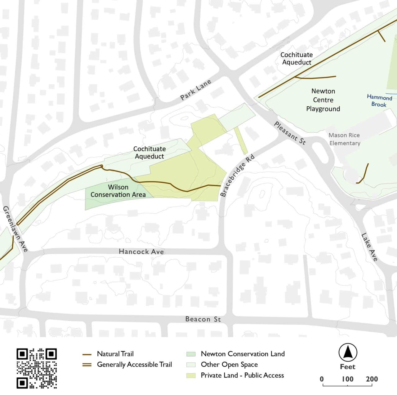
Click map for larger image •
Owner & Administrator Websites
Newton Conservators (conservation restriction holder on privately owned parcel)
Photo Gallery


First three photos shown here. Click a photo to view the complete slideshow or click here to browse the complete gallery.
History
~1856
House built by real estate developer Roswell Turner on land between the aqueducts. According to a 1983 Newton Historical Society report, “Except for the Colonial Revival trimming and a twentieth century addition to the north facade, this house represents the Italianate Style complete with hipped roof, tower, and arched windows. From 1844, Mr. Turner lived in Newton Centre where he bought and sold numerous properties. A manuscript by Margaret Orr in the Jackson Homestead Collection describes him as the real estate developer of Pelham Street, Lake Street, and the part of Beacon Street near the village center. Charles Davis, owner until 1907, called the estate ‘Mount Pleasant.'”
1986
Mount Pleasant listed on the National Register of Historic Places.
1990s
Half-acre parcel above the Sudbury Aqueduct donated to the City of Newton by Richard and Andrée Wilson, to form the Wilson Conservation Area.
2012
Conservation restriction on adjacent 1.5 acre parcel on Bracebridge Road donated by the Wilsons to the Newton Conservators.
Features
Aqueduct Trail, Biking: Prohibited, Conservation Area, Dogs On Leash, MBTA Green Line, Other Long Route
Additional Information
Newton Assessor’s Map ID: 64016 0023 and other parcels
The story of Jolly’s Hollow: How conservation land builds community Newton Tab, November 30, 2017 (reprinted in Newton Conservators Newsletter, Spring 2018)
 1895 Bromley Atlas of Newton

Report a Problem