Edmands Park
Overview
Surrounded by stone walls and bordered by Boston College Law School on one side, this park contains woods, small clearings, wetlands, Edmands Brook, and a glacial esker. Its open oak forest contains beeches, locusts, maples, birches, and pines. Edmands Brook is an intermittent stream whose source is south of Cotton Street and east of Burrage Road. The brook empties into a large wetland, filled with frogs and tadpoles. The esker can be seen to the right as you enter the park from Blake Street. Note the sandy soil and the steep sides of the esker as you walk along its “back.”
The park is used for walking, jogging, nature study, birding, cross-country skiing, and sledding.
Size: 33 acres Longest Walk: 1 mile Acquired: 1913
Maps
Locator Map and Driving Directions
Trail Map
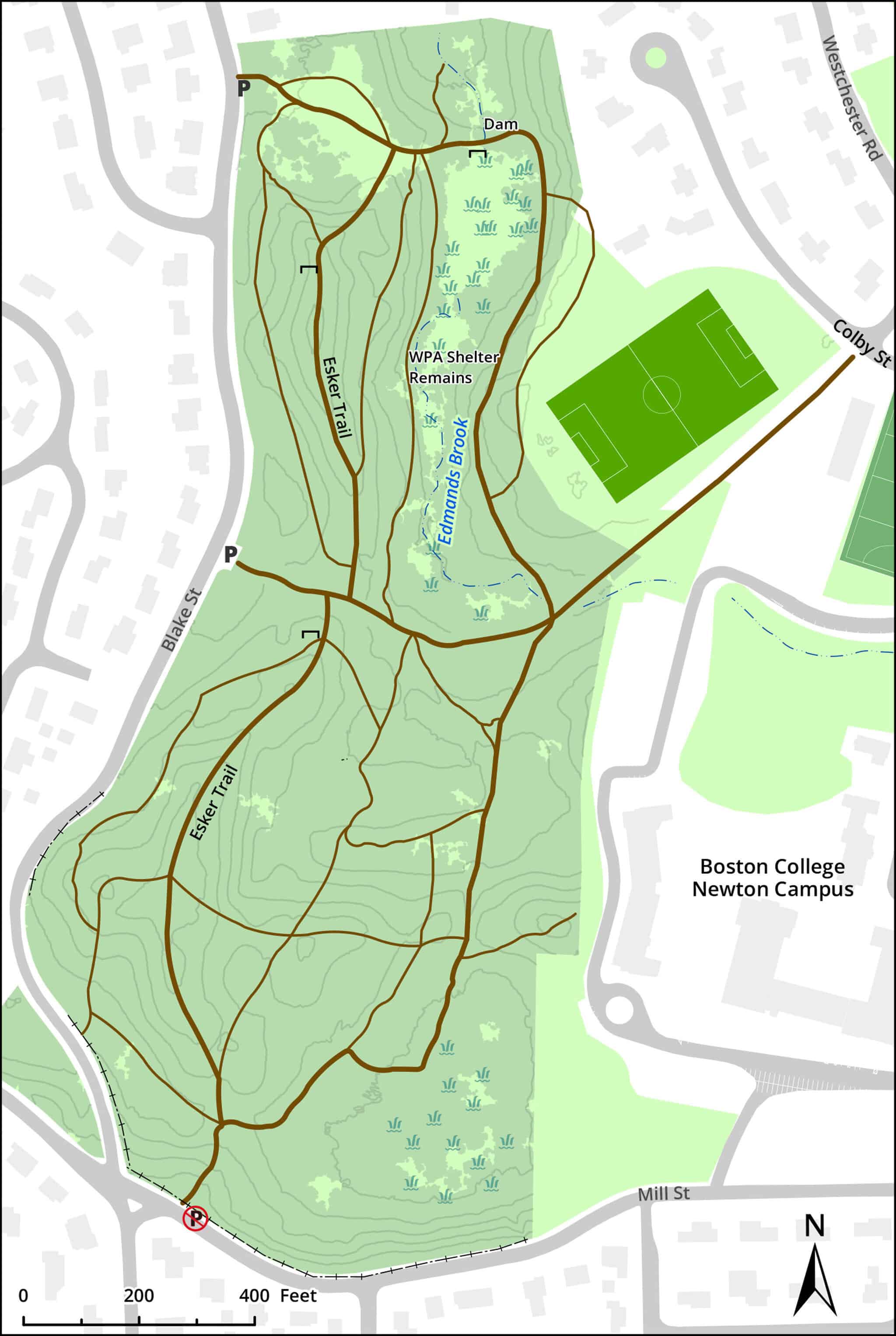
Click map for larger image •
Owner & Administrator Websites
Photo Gallery


First three photos shown here. Click a photo to view the complete slideshow or click here to browse the complete gallery.
History
1913
Donated to the city by the Edmands family in memory of J. Wiley Edmands and A. Lawrence Edmands.
1930s
Trails and dammed skating pond were created by Depression-era relief work.
Features
Birding Hotspot, Dogs On Leash, Geologic Features, Historic Site, Other Long Route, Winter Sports
Additional Information
Newton Assessor’s Map ID: 13021 0004 and other parcels
Advocates & Caretakers:
Other Information:
Photos by Cynthia Staples:

“An Analysis of Bird and Tree Diversity in Edmands Park”
Report a Problem
Report a Problem in a Newton City Park