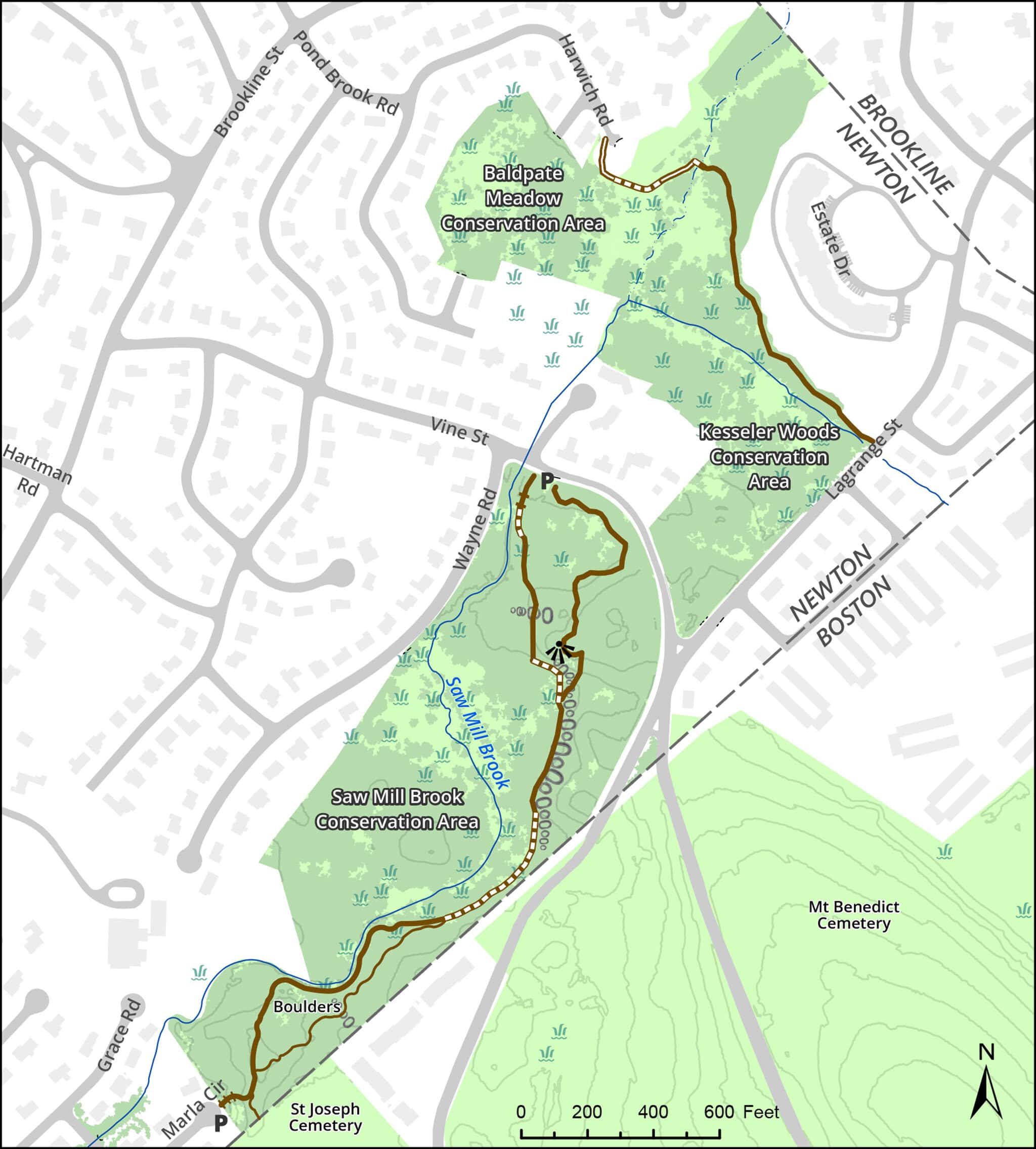
Saw Mill Brook and Kesseler Woods Conservation Areas
Overview
This site consists of three adjacent conservation areas: Saw Mill Brook, Kesseler Woods, and Baldpate Meadow.
The Saw Mill Brook trail follows brook through wooded upland and wetland and by old stone fences and dramatic puddingstone outcroppings. The trail system in Kesseler was under development as of 2026.
The area connects to a much larger green corridor running through West Roxbury and South Newton. Near the Marla Circle end of the trail, you can walk into St. Joseph Cemetery and from there, cross Baker Street to Brook Farm Historic Site. Beyond Brook Farm is the Blue Heron Trail along the Charles. More about the long walk
Size: 27 acres Longest Walk: 0.8 miles Acquired: 1979 to 1985, and 2004
Maps
Locator Map and Driving Directions
Trail Map
Click map for larger image •
Owner & Administrator Websites
Conservation Commission: Kesseler Woods
Conservation Commission: Baldpate Meadow
Photo Gallery


First three photos shown here. Click a photo to view the complete slideshow or click here to browse the complete gallery.
History
1979
City acquired northwest parcel using state self-help funds.
1982
City acquired southern parcel from Temple Beth Avodah and from Benjamin Kaplan, using self-help funds.
1985
City acquired middle parcel by eminent domain, using state self-help funds.
2004
NSTAR sold 42-acre Kesseler Woods to a developer. City of Newton received a conservation restriction on about 30 acres, including 9-acre West Kesseler Woods alongside Saw Mill Brook. The larger Kesseler Woods parcel lies across Vine Street.
Features
Biking: Prohibited, Conservation Area, Dogs On Leash, Geologic Features, Other Long Route, River/Lake/Pond, Scenic View