Kennard, Lost Pond, and Skyline Park
Overview
This is a post-agricultural forest grown up on 19th century farmland. The mixed and conifer woodlands reveal colonial stone walls, a red maple swamp with century-old trees, and a Sensitive Fern marsh.
The park has a wooded hillside with puddingstone and Brighton Volcanic outcrops. Pigeon Hill is a woodland with a circular stone wall. The conservation area protects the South Meadow watershed. The house is the headquarters of the Newton Parks and Recreation Department, and is not open to the public.
Size: Total 120 acres, comprised of Kennard Park (16 ac), Kennard Conservation Area (32 ac), Skyline Park (15 ac), Lost Pond Conservation Area (26 ac), and Lost Pond Reservation (33 ac) Longest Walk: 1.7 miles, on loop including Lost Pond Acquired: Park: 1982; Conservation area: 1978
Maps
Locator Map and Driving Directions
Trail Map
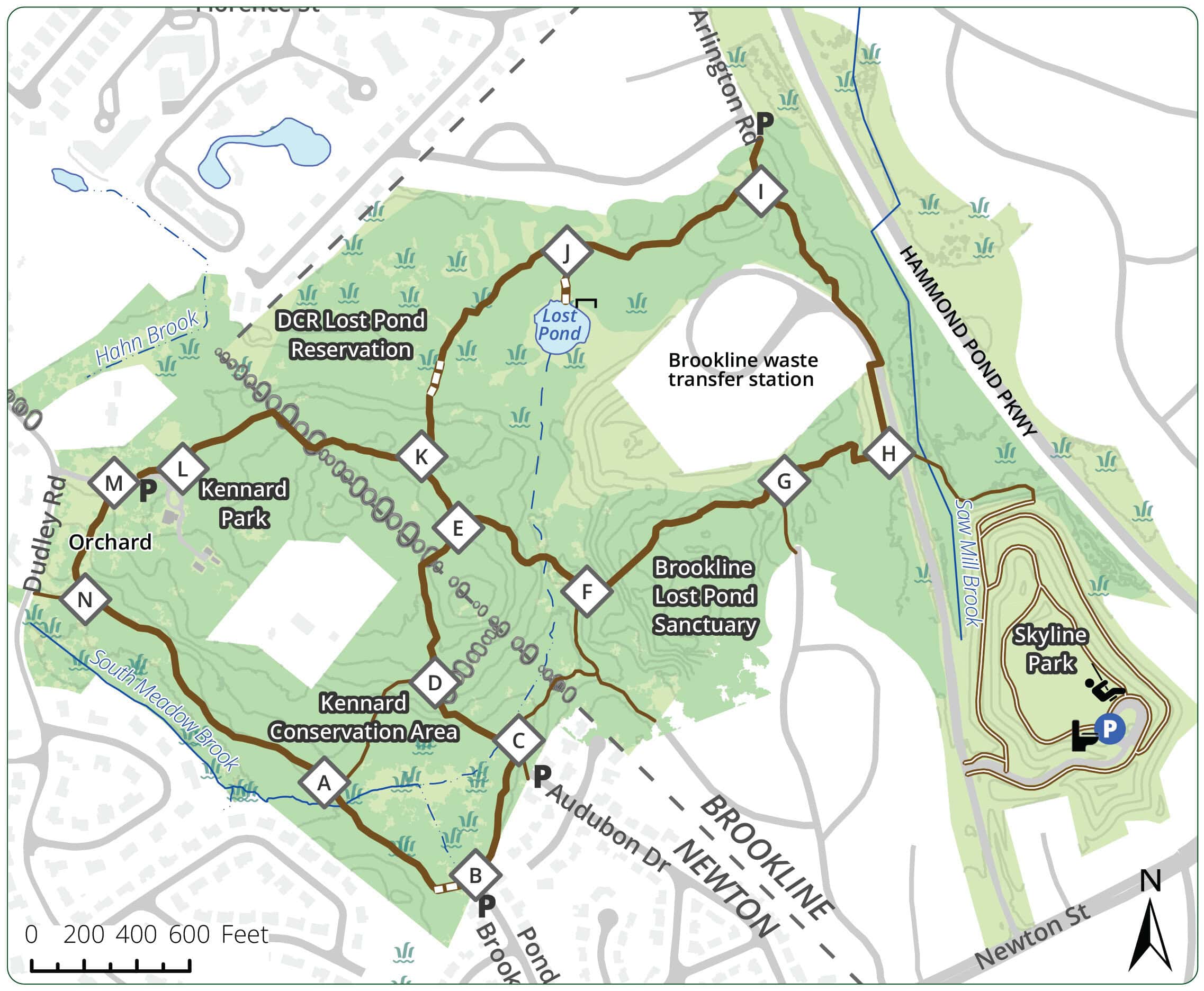
Click map for larger image •
Owner & Administrator Websites
Kennard Conservation area: Newton Conservation Commission
Lost Pond Reservation: Mass. Dept. of Conservation and Recreation (DCR)
Lost Pond Sanctuary: Town of Brookline
Skyline Park: Town of Brookline
Photo Gallery


First three photos shown here. Click a photo to view the complete slideshow or click here to browse the complete gallery.
History
1906
Dr. Harrison Kennard bought the land. Previous owner used to shoot passenger pigeons on Pigeon Hill and sell them at Faneuil Hall.
1978
City acquired 32.2 acres from the Kennard family.
1982
More land and the house were willed to the city by Dr. Kennard for Kennard Park.
Features
Biking: Prohibited, Birding Hotspot, Conservation Area, Dogs On Leash, Geologic Features, Other Long Route, Picnic Tables, Playground, River/Lake/Pond, Scenic View, Sports Fields, Toilet Facilities, Winter Sports
Additional Information
Newton Assessor’s Map ID: 82004 0023 and other parcels
ADVOCATES & CARETAKERS: Friends of Kennard Park; email: friendsofkennardpark@gmail.com
Managed by Kennard Park Board of Trustees.
Report a Problem
Report a Problem in a Park or Conservation Area