Hunnewell Woods and Park
Overview
Park featuring wildflowers, deciduous trees and typical suburban wildlife. Path along wooded slope leads to a playground. The park includes an off-leash dog area.
Size: Woods, 1.6 acres; Park, 4.6 acres. Longest Walk: 0.6 miles Acquired: 1969 (park) and 1979 (conservation area)
Maps
Locator Map and Driving Directions
Trail Map
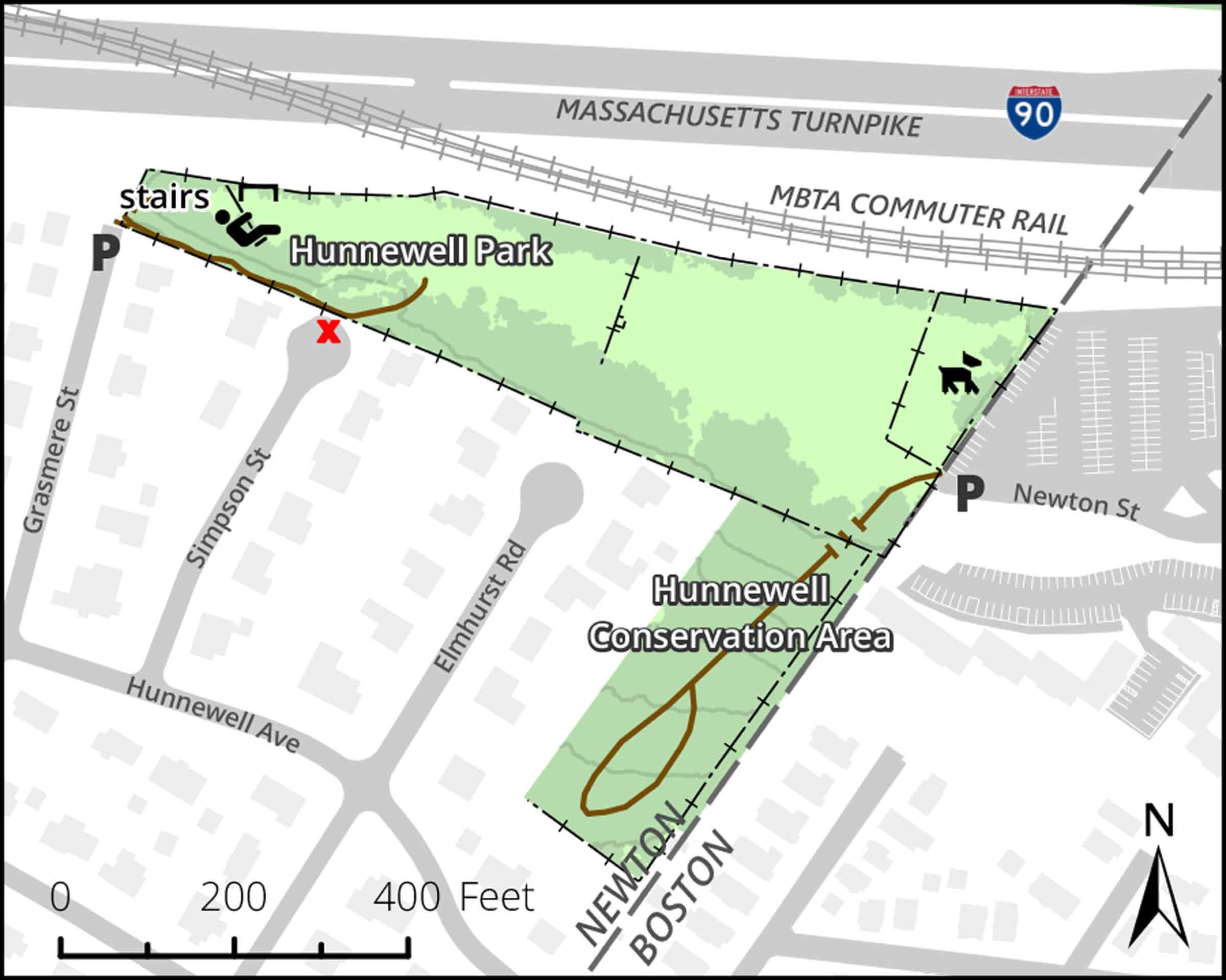
Click map for larger image •
Owner & Administrator Websites
Photo Gallery


First three photos shown here. Click a photo to view the complete slideshow or click here to browse the complete gallery.
History
1874
Land now comprising Hunnewell Park was owned by Boston & Albany RR, and was known as the “Faneuil Yard.” Rail line was adjacent to this land. Land now in Conservation Area was part of rear of lots fronting on Washington Street owned by the Harris and Allen families. All of this land was part of the City of Boston, not Newton.
before 1886
Boston/Newton boundary moved to the East, shifting this land into Newton.
1964
Commonwealth of Massachusetts purchased the railroad yard for Mass Turnpike extension, which was built along the northern edge of the parcel.
1969
After nearby residents petitioned for a playground, the City purchased the southern part of the former rail yard, to create Hunnewell Park.
1979
Conservation Commission purchased 1.6 acres of land from Thomas and Ruth Cannon to create Hunnewell Woods Conservation Area.
Features
Conservation Area, Dogs Off Leash, Playground, Sports Fields
Additional Information
Newton Assessor’s Map ID: 71026 0014, 71026 0024

Report a Problem
Report a Problem in a Park or Conservation Area